
Here’s a quick shock: Oregon’s coastline stretches roughly 362 miles, and the Columbia River Gorge alone hosts over 90 waterfalls on the Oregon side — enough variety to shape a whole summer of outings.
I write from many road miles and early mornings. I’ll take you from the dramatic coast north to south, then inland through the gorge, alpine lakes, Crater Lake’s rim, Bend, Ashland, and the Alvord Desert.
My approach blends iconic sights like Multnomah Falls and Crater Lake with quieter stops — short beaches and ghostly desert sunsets. I note when roads or seasons shape your time and when sunrise or tide makes a scene unforgettable.
Expect practical tips: route order that flows, timing for waterfall corridors, and simple safety notes for tides and mountain weather. This is a traveler-first game plan I use again and again.
Key Takeaways
- I guide a north-to-south coastal arc, then inland loops for easy trip planning.
- Season and road closures matter — plan summers for rim drives and Cascade routes.
- Mix famous icons with quieter beaches and high desert for balance.
- Timing (sunrise, tide, season) often makes or breaks a viewpoint.
- Practical safety tips and alternate stops keep your days achievable.
How I Plan an Oregon Road Trip: Best Time, Routes, and Car Tips

A few simple choices about when I go and which way I drive change a good trip into a great one. I match each landscape to a season, then build days that flow without rush.
Timing for landscapes: I aim late spring or early fall for waterfall corridors when crowds thin. I save summer for high country and Crater Lake rim drives. The coast works well in shoulder seasons because conditions shift fast from fog to sun.
Route strategy
I choose north-to-south when morning sun on ocean pullouts matters. I head south-to-north when afternoon light highlights headlands. Direction matters less than stopping at sunrise or sunset and pacing towns for fuel and food.
Car and road prep
- Install new windshield wipers and keep a towel for foggy mornings.
- Pack layers and a waterproof shell; coastal weather flips fast.
- Expect mixed gas rules—some counties still use attendants—so keep a card handy.
- Wear grippy footwear for slick rocks and tidepools.
| Plan Length | Focus | Typical Outcome |
|---|---|---|
| 7 days | Coast or Gorge focus | Good sampler; less inland depth |
| 10 days | Coast–Gorge–Crater loop | Comfortable pace; inland highlights included |
| Flexible days | Shoulder-season coast | Fewer crowds; variable weather |
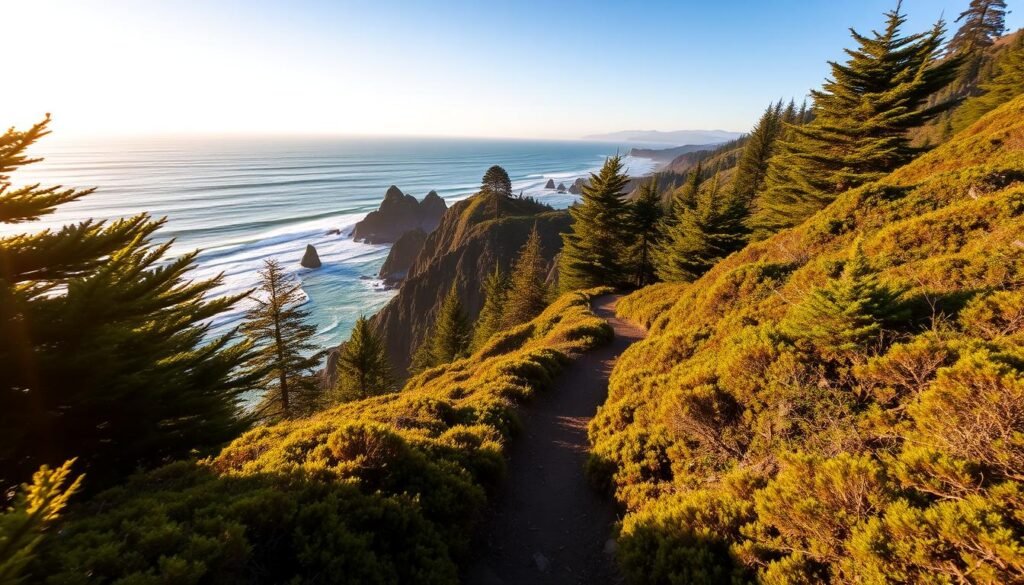
The Oregon Coast Road Trip: 362 Miles of Cliffs, Beaches, and Small Towns

The 362 miles from the Columbia River mouth to the California border feel like a compressed atlas of coastal moods. I map a route that strings lighthouse overlooks, shipwreck history, headland hikes, and sandy coves into one fluid road day after day.
Astoria to Brookings: why this is my favorite U.S. coastal drive
I pick this way for variety. Short hops reveal dramatic headlands like Ecola, historic sites in Astoria, and quiet dunes near Florence. The mix means I can stack a sunrise atop the Astoria Column, a tide walk at Hug Point, and a Thor’s Well sunset in one trip if timing aligns.
Where I stop for ocean views, history, and amazing sunsets
I keep a short list of must-stops and flexible pullouts: Cannon Beach under Haystack Rock, Tillamook Creamery for a quick ice cream break, Cape Perpetua’s overlooks, and Cape Meares for old-growth Sitka spruce. If fog rolls in at one headland, I pivot to a lower cove like Agate Beach to chase sunset light.
Three days on the coast: my quick-hit itinerary
Day 1: Astoria south to Cannon Beach — history, Ecola views, and an evening on the sand.
Day 2: Tillamook capes, Neskowin, and Lower Cascade Head — capes, creeks, and quiet beaches.
Day 3: Newport through Yachats to Florence — Devil’s Punchbowl, Cape Perpetua, and dune-flanked finishes.
- Short walks for quick views, longer hikes for summit panoramas (Neahkahnie when skies clear).
- Use small towns as warm bases for food and fuel; I link my notes to coast highlights: coast highlights.
- Southern sleepers I never skip: Blacklock Point, Arizona Beach, and Cape Sebastian for quiet final acts.
Astoria & Northern Coast Classics: Columbia River to Cannon Beach

Morning light at Coxcomb Hill turns the river and town into a quiet postcard worth getting up for. I climb the Astoria Column’s 164 steps or walk the Cathedral Tree Trail’s two-mile descent to beat the crowds and lock in broad Columbia River views.
Column climbs and mossy trails at sunrise
I aim for sunrise at the column or the trail below when the air is still. The climb wakes me up and gives clear direction for the day.best-places-to-visit-in-europe
Fort Stevens and the Wreck of the Peter Iredale
Then I swing west to Fort Stevens. I stretch out on more than 15 miles of sand and photograph the famous wreck, a perfect stop for coastal history and long shoreline views.
Ecola choices: Crescent Beach vs. Indian Beach
At Ecola I check drive-up overlooks, then decide between Crescent’s quiet route or Indian’s easy access. If time allows, I do both; otherwise Crescent wins for solitude and dramatic cliffs.
Haystack Rock and evenings in Cannon Beach
I time my arrival in Cannon Beach for late afternoon. I wander the town, grab dinner, and linger as Haystack Rock glows at sunset. Layers are a must—marine air chills fast after a warm afternoon.
“These northern classics set the tone: short trails, seaside evenings, and viewpoints that keep pulling me back.”
Hidden Gems Along the North Coast: Hug Point to Neahkahnie Mountain

A short run of shoreline between Hug Point and Neahkahnie hides quiet trails and sudden viewpoints few people expect.
Hug Point is a low-tide playground. I check tide charts before I go so I can walk the old “road,” peer into sea caves, and reach the small waterfall without getting cut off by surf.
Hug Point tides, sea caves, and the historic “road”
The rocky shelf shows remnants of the historic coastal route when the tide is out. Explore carefully and keep an eye on incoming water.
Cove Beach solitude and Short Sand surf vibes
I swing by Cove Beach when I want quiet. Parking is tight—park legally and leave no trace.
Oswald West’s Short Sand is a quick surf and forest reset. The creek walk is short, and the local surf scene gives the day a lively pulse.
Neahkahnie Mountain: choosing south vs. north trailheads
For navigation I often pick the North Trail; it’s steeper but simpler. The South Trail feels easier but has more junctions—stay alert.
“If clouds threaten the summit, I scout from Nehalem and choose a lower trail that still gives great views.”
- My one-day flow: Hug Point at safe tide, Short Sand midday, Neahkahnie if skies clear.
- Pack a wind layer; ridgeline viewpoints cool fast.
Tillamook Coast: Creamery Treats, Capes, and Easy Lookouts

I plan a day that flips from a bustling creamery tour to a calm lighthouse overlook and a brief descent to a peaceful cove. This stretch of the oregon coast fits busy and quiet stops within a few miles, so you can taste, walk, and linger without long drives.
Tillamook Creamery draws big lines year-round. I aim for off-peak hours or late afternoon, grab my scoop, and wander the exhibits. I often stash a pint in a cooler for a picnic later at Cape Meares.
Taste, lighthouse, and a quiet cove
I pivot from the creamery to Cape Meares for the lighthouse view and the giant Sitka Spruce. It’s an easy, rewarding stop that balances the crowd.
Then I take the stairs down to Short Beach. Larson Creek Falls often spills toward the sand, and the cove feels like a private spot after the creamery rush.
- I respect tight roadside parking and local signs near Short Beach.
- I pack a windbreaker for cape lookouts and keep a camera ready for seabirds or eagles.
“Snack, viewpoint, uncrowded cove — this busy-quiet-busy loop keeps the day calm and satisfying.”
| Stop | Why I go | Timing |
|---|---|---|
| Tillamook Creamery | Ice cream, tours, shopping | Off-peak or late afternoon |
| Cape Meares | Lighthouse, Sitka Spruce | Short stroll; quick wildlife chances |
| Short Beach & Larson Creek | Quiet cove, small falls | After lighthouse; low tide ideal |
Central Coast Stunners: Neskowin, Cascade Head, and God’s Thumb

A slow start in Neskowin lets the shoreline and Proposal Rock set the day’s pace. I like a morning walk here because the town feels quieter than busier coastal hubs. Proposal Rock sits just offshore and makes an easy, photogenic loop for an early stroll.
Neskowin’s Proposal Rock and slow mornings in a small town
I base myself in Neskowin when I want a relaxed morning and short beach walks. The vibe is calm, and the town gives quick access to nearby trails without a long drive.
Lower Cascade Head: my favorite sunset hike
The Lower Cascade Head Trail is about 4.5 miles and shines at sunset. Open headlands light up in gold, so I bring a headlamp for the forested sections on the way back.
God’s Thumb etiquette and trail preservation tips
God’s Thumb draws a lot of people. Erosion near the viewpoint is real, so I stay on durable surfaces and avoid the crumbling edge.best-national-parks-to-visit-in-the-us
- I rotate these hikes by fog and cloud ceilings; if the Thumb is socked in, I aim for Cascade Head meadows.
- Pack layers and a warm hat even in summer; wind on the headlands chills fast.
- Park thoughtfully, keep noise low, and give others space on narrow trails.
- After a sunset push, I often refuel at McMenamins Lighthouse Brewpub in Lincoln City for pizza and a pint.
“Neskowin is a reset between busier hubs — quiet mornings here make the rest of the day easier and more enjoyable.”
Newport to Yachats: Oceanfront Walks and Rugged Cape Perpetua

A calm morning on the broad sand at Agate Beach sets the tone for a relaxed mid-coast day. I start with a long, easy walk across rolling dunes and wide shoreline that contrast nicely with nearby cliff overlooks.
Devil’s Punchbowl is a short scenic stop and a handy lunch option. I usually pair the lookout with a quick bite at a nearby cafe so I keep momentum without losing time.
Cape Perpetua trifecta and timing
I budget time for the Perpetua Overlook, Devil’s Churn, and Thor’s Well since they sit minutes apart. The fee area accepts interagency passes, so I park once and see multiple features.
I check tide tables before I move in. Thor’s Well and Devil’s Churn are most dramatic near high tide. I keep safe distances from waves and wear slick-resistant shoes for wet rock and tidepooling.
“Newport–Yachats is a compact corridor of quick wins—great when I want variety without long drives.”
- I treat Agate Beach as a calm morning reset; I’ll return for sunset if wind eases.
- Plan an easy hike at Perpetua and time it for high tide when ocean spray makes the views sing.
Florence to the Southern Coast: Oregon Dunes, Lighthouses, and Coves

In a single day I can trade soft sand for a dune buggy, climb to a lighthouse view, and listen for seals in a sea cave.
Hiking the dunes or grabbing a dune buggy
I split my time at the oregon dunes between long, quiet hikes and a short dune buggy tour out of Florence when I want an adrenaline boost.best-island-to-visit-in-hawaii
Watch for OHV zones versus hiking-only areas and pick a calmer access if a launch looks crowded. Carry extra water—the sun bouncing off sand can drain you fast.
Heceta Head and Hobbit Beach access
I usually take the Hobbit Beach trail up to Heceta Head when I can. The climb rewards me with sweeping cliff views and a classic lighthouse photo at golden hour.
Paid parking at the headland is an option if time is tight, but the trail adds context and a prettier route.
Sea Lion Caves: booking and timing
Sea Lion Caves is privately run and fills on summer weekends. I book tickets ahead and aim for mid-morning on busy days so my day’s timing stays smooth.
“A dune ride, a lighthouse hike, and a sea cave tour make a compact, energy-packed run along the oregon coast.”
- I like a meal in Florence old town between stops; it resets energy before heading south.
- Mix one big dune hike with a short motorized blast for variety and pace.
Remote Southern Highlights: Port Orford to Brookings

This remote arc of shoreline delivers long headland views, short trail loops, and a strong chance of solitude.
I often start at Blacklock Point for a low-effort, high-payoff cliff view. The loop is about 4 miles roundtrip through Floras Lake State Park and stays mostly flat. In winter, parts of the trail can sit under water, so I either detour or wear waterproof footwear.
Headlands, a small museum, and picnic benches
Port Orford Heads State Park is an easy loop with excellent picnic viewpoints. The little Coast Guard museum adds context and makes the stop more satisfying. I bring a small lunch and linger on the benches when the light is calm.
Short walks and a half-day descent
Arizona Beach is a mellow spot for a beach walk or a simple summer camp night. Sisters Rock is a quick mile out-and-back to dramatic sea stacks—perfect as a leg-stretcher between longer trails.
I plan Cape Sebastian as a half-day. The 3.6-mile trail drops through forest to Hunters Cove, and the coastal vistas north and south are wide and quiet. I carry a headlamp when I chase sunset here or at Blacklock so I can climb out safely after dusk.best-time-to-visit-bali
“I budget extra drive time on this remote stretch—the distances aren’t long, but the pullouts and viewpoints beg for stops.”
- Quick tips: Wear waterproof shoes in winter; pack water and a headlamp; expect solitude even in summer.
- Timing: Allow an extra 30–45 minutes per stop for photos and short hikes.
- Local resource: For regional planning and seasonal updates, check the wild rivers and coast guide at Oregon’s Wild Rivers & Coast.
| Spot | Distance / Trail | Why I stop |
|---|---|---|
| Blacklock Point | 4 miles roundtrip | Flat loop, cliff views; winter crossings possible |
| Port Orford Heads | Short loop | Coast Guard museum, picnic benches, easy viewpoints |
| Cape Sebastian | 3.6-mile trail | Forest descent to Hunters Cove; sweeping coastal views |
| Sisters Rock | 1 mile out-and-back | Quick sea-stack stroll; great short hike |
| Arizona Beach | Beach access / camping seasonally | Mellow walk, summer camping, stargazing |
Best Places Beyond the Coast
Beyond the surf and headlands, Oregon’s interior folds a different kind of wonder — alpine rims, river canyons, and desert night skies.
Crater Lake is three experiences: go high for Watchman or Garfield Peak panoramas, go low via Cleetwood Cove to touch the water, and drive the Rim when snow allows.
Gorge and waterfalls
The Columbia River Gorge packs Multnomah, Latourell, Wahkeena, Punchbowl, and Dry Creek Falls into one corridor. I start early for Multnomah and watch permit rules at Dog Mountain during wildflower season.
Bend, lakes, and peaks
Bend is a great base for the Cascade Lakes Byway, Tumalo Falls, and float trips on the Deschutes. South Sister and Green Lakes offer longer hikes if you have the time.
Rivers, parks, and desert nights
The McKenzie River’s Tamolitch Blue Pool makes a perfect day hike along clear river trails. Ashland blends culture and trails — Litihia Park and nearby Siskiyou hikes pair well with an evening show.
For a very different night sky, I plan a clear-weather window at the Alvord Desert, soak at Alvord Hot Springs, and drive toward Steens Mountain for vast views.
“I balance packed days with easy pullouts so a tight itinerary still feels relaxed.”
- Seasonality matters: Rim drives and byways open in summer.
- Base in Bend or Hood River for efficient day runs and good food.
The Columbia River Gorge: Waterfalls, Wildflowers, and Big Views
The Columbia River corridor packs dramatic scenery into short drives and compact hikes, so I plan a single day that hits big favorites and quieter options.
Waterfall corridor: Multnomah, Latourell, Wahkeena, and Dry Creek
I start at dawn at Multnomah — it’s the busiest natural site in the Pacific Northwest, so early arrival keeps the parking stress low.best-hawaiian-island-to-visit
From there I link Latourell and Wahkeena, then swing to Dry Creek Falls near Cascade Locks for a short mile trail and a picnic by the river.
Wildflower season picks: Tom McCall Point and Dog Mountain
For blooms I choose my window in late spring to early summer. Dog Mountain gives epic carpets but needs weekend permits at peak bloom.
Tom McCall Point offers sweeping meadows and consistent views with fewer crowds on a clear morning.
Vista House, Larch Mountain, and Washington-side alternates
Vista House is an easy viewpoint when someone in my group prefers minimal walking. I save Larch Mountain’s summit road for clear days; it typically opens May through November.
- Alternates: Hamilton Mountain and Coyote Wall on the Washington side for ridge hikes and quiet panoramas.
- Gear: Traction footwear and a light shell for misty trails near falls.
- Timing tip: People peak late morning at Multnomah; I start at dawn and loop to less-busy spots by mid-morning.
For regional planning I also check the Columbia River Gorge region guide at Columbia River Gorge region for seasonal updates and closures.
“Short hikes, big views, and a well-timed picnic at Cascade Locks make the canyon feel full without rushing.”
Crater Lake Essentials: Go High, Go Low, Go Around
A visit to Crater Lake feels like three short trips: a high summit, a lakeside plunge, and a slow road around the rim.
Watchman Peak vs. Garfield Peak
Watchman is a short hike to a fire lookout that rewards you fast with classic lake views. I use it for sunset when I want a compact climb and big color without a long effort.
Garfield is a longer, steeper route that gains more elevation and gives broader panoramas. I choose Garfield when I have energy and clear skies for extended views.
Cleetwood Cove access and summer swim realities
Cleetwood Cove is the only legal water access. The trail drops steeply and the water stays cold even in summer, so I treat a dip as a quick payoff, not a long swim.
Rim Drive timing and seasonal closures
Rim Drive often opens mid to late summer depending on snow. I check road status and plan partial loops if the full loop isn’t available, then save a morning for any overlooks I missed.
“Even short miles at altitude feel larger, so I pace hikes and carry layers, sun protection, and extra water.”
- I stack a high + low combo in one day: Watchman first, then Cleetwood if time allows.
- I watch smoke forecasts in late summer and shift plans if visibility drops.
Bend and the Cascade Lakes Scenic Byway: Peaks, Lakes, and Trails
A day on the Cascade Lakes Byway folds high alpine lakes, volcanic ridges, and quiet paddling into a single loop. The road runs roughly 66 miles and often closes west of Mount Bachelor when snowpack returns — think October through June for many years.
Sparks, Devils, and Elk Lakes: my sunrise-to-swim loop
I start at Sparks Lake for dawn reflections of South Sister, then paddle or walk around Devils Lake midday, and end with a relaxed swim at Elk Lake. This sequence gives calm water, turquoise color, and a warm late-afternoon shoreline.
Tumalo Falls and the Green Lakes Trail
I mix quick classics like Tumalo Falls with half-day hikes on the Green Lakes Trail when I want alpine basins and extended views. The Green Lakes route links high meadows between South Sister and Broken Top and rewards steady hiking.best-islands-to-visit
When the byway opens and where I base in town
I base myself in Bend for food, breweries, and easy returns after trail days. Pilot Butte makes a short golden-hour climb when I still have energy.
- Timing: Park early on weekends—lots fill fast at Sparks and Devils.
- Pace: Rotate water days and hiking days to keep legs fresh.
- Gear: Bring bug spray in early summer, sun protection on pumice, and layers for mountain breezes.
“Start hikes early to beat afternoon storms and enjoy the clearest views.”
| Highlight | Why go | When open / note |
|---|---|---|
| Sparks Lake | Sunrise reflections, paddling | Accessible year-round low snow; park early weekends |
| Devils Lake | Turquoise water, South Sister access | Popular; summer fills fast |
| Elk Lake | Swimming, camping | Warm afternoons; great for a chill finish |
| Tumalo Falls | Quick waterfall stop | Easy access from Bend; good for short hikes |
| Green Lakes Trail | Long alpine basin hike, superior views | Best in summer; high-clearance trailheads may open later |
Small Towns I Love: Hood River, Florence, Gold Beach, and More
I lean on compact towns as rhythm points on long days — they give me coffee, a map, and a quick way back to nature. These hubs make it easy to switch from a hike to a meal without losing momentum.
Hood River: Fruit Loop, river sports, and downtown eats
Hood River anchors my Gorge runs. I loop the 35-mile Fruit Loop for orchards, cideries, and wineries.
I often watch windsurfers or book a lesson at Big Winds, then rest at the historic Hood River Hotel. A short walk takes me to lively downtown cafes, and the toll bridge makes a quick cross to Washington if I need a different view.
Florence: old town charm and dunes access
Florence is a perfect mid-coast stop. I pair old town meals with dune play at the Oregon Dunes National Recreation Area.
A dockside stroll and a short drive put me at lighthouse hikes or sand trails within minutes.
Gold Beach: breakfasts and quiet beaches
In Gold Beach I start with a hearty meal at Double D’s Cafe, then head for miles of nearly empty sand.
These towns work as short rest spots with good coffee, groceries, and fast access to river or beach walks. I book ahead for festival weekends and treat each stop as a small reset on the road.
Trip Logistics: Three Days vs. Ten Days, Stays, and Safety on Trails
I map logistics so each day feels like progress, not a sprint. That way driving stays reasonable and you get time for at least one standout hike, an easy viewpoint, and a relaxed evening base.
Short trip options
For three days I offer two clear flows. One is a coast sampler: Astoria/Cannon Beach, Tillamook capes, and Newport–Yachats.
The other leans Gorge-heavy with a coastal sunset add-on if weather cooperates. Both three days plans keep daily drives short and rewarding.best-time-to-visit-cancun
Ten-day loop
A ten days route gives real depth: north coast through central capes, Newport, Florence and the dunes, then inland to Crater Lake, Bend/Cascade Lakes, finishing with the Columbia River Gorge.
I book stays where logistics matter: Cannon Beach or Neskowin north, Newport or Yachats mid-coast, Gold Beach or Brookings south.
Trail and coastal safety
Check tide tables for Hug Point and Thor’s Well. Never turn your back on surging surf and keep distance from wet ledges.
Stay on durable surfaces at erosion hot spots like God’s Thumb and manage food on forested trails—black bears live along some coast forests. Carry spray only if you know how to use it.
- Practical car notes: some counties still have attended pumps; keep cash or card ready.
- Bring fresh windshield wipers, layered clothing, and sturdy trail shoes with traction.
“Keep daily drives reasonable so every day feels full, not rushed.”
| Plan | Focus | Where to stay |
|---|---|---|
| Three days (coast) | Sampler of north, mid, south coast | Cannon Beach; Newport |
| Three days (Gorge) | Waterfalls and viewpoints | Hood River |
| Ten days | Coast → Crater Lake → Cascade Lakes → Gorge | Mix of coastal towns and Bend |
Conclusion
I wrap this guide with a simple plan: one trail, one viewpoint, and one small-town stop each day. That approach lets you sample the oregon coast, the Columbia River Gorge, and high-country peaks without rushing.
Give each region the right time and season. Morning light and checked routes often change a good photo into a great one. Small towns like Hood River, Florence, and Gold Beach make handy bases for longer days.
Use this post as a checklist—mix iconic viewpoints with quieter coves and swap days for weather. If you decide to visit Oregon, pick alternates, pack layers, and plan early starts.best-time-to-visit-aruba
I’d love to hear your one favorite discovery from the road and which places you’ll explore next.